
Globalopen Satellite 30cm NASA Imagery Globe


Original price was: 140 $.114 $Current price is: 114 $.
Globalopen Satellite 30cm NASA imagery globe with true-color satellite photography cartography, cloud-free composite surface, relief elevation integration, and polished chrome stand for scientific and design display.
The Globalopen Satellite 30cm NASA Imagery Globe is a photographic globe — a terrestrial sphere whose surface carries a true-color satellite photograph composite of the Earth rather than a drawn or painted cartographic map. The photograph is derived from NASA’s Blue Marble dataset — a cloud-free mosaic of satellite imagery captured across multiple orbit passes and composited into a single seamless planetary image that represents the Earth’s surface as it appears from low Earth orbit without cloud cover. The result is a globe that shows the actual color of the Earth’s surface: the deep blue of the open ocean, the pale turquoise of shallow tropical seas and reef systems, the green of forested continents and agricultural plains, the brown and tan of arid regions and deserts, the white of permanent ice sheets and glaciers, and the dark grey-green of mountain ranges. This photographic accuracy provides a geographic education tool that no drawn map can replicate — the student can see the actual Saharan sand sea, the actual extent of the Amazon rainforest, the actual glacier coverage of Greenland and Antarctica. Country border lines and country name labels are printed over the photograph layer in a fine translucent white that is legible against the photograph without obscuring it. The globe is printed at Globalopen’s highest lithographic resolution to preserve the photographic detail that distinguishes this globe from products that print a scaled-down satellite image at a resolution insufficient for the globe’s surface area. The polished chrome meridian ring and base provide a hardware treatment appropriate to the technical character of the cartographic content.
Be the first to review “Globalopen Satellite 30cm NASA Imagery Globe”
Related products
Uncategorized
Globalopen Horizon 35cm floor-standing globe with 1.2m full-height stand, antique-style cartography, solid wood tripod base, full meridian ring, and stable weighted feet for living room and library display.
Uncategorized
Globalopen Gem 20cm semi-precious stone sphere globe with inlaid lapis lazuli ocean and malachite continent detail, hand-finished surface, and polished brass stand for luxury gifting and collector display.

Uncategorized
Globalopen Relief 35cm extra-large physical globe with maximum-detail raised terrain, ocean floor mapping, hypsometric color gradient, labeled geographic features, and weighted floor stand for library and museum display.

Uncategorized
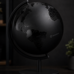
Globalopen Architect 30cm Black Edition desk globe with matte black ocean treatment, white country labels, gold accent meridian ring, and concrete-finish base for modern interior design.

Uncategorized
Globalopen Zodiac 25cm astrological globe with 12 zodiac constellation artwork, ecliptic path line, celestial equator, planet position guide, and gold-finish stand for astrology and decorative display.
Uncategorized
Globalopen Classic 25cm antique-style globe with aged parchment cartography, decorative compass rose, brass-finish meridian ring, and dark mahogany-finish base for vintage home decor.

Uncategorized
Globalopen Academy 30cm dual-map globe with switchable political and physical map modes, internal LED color-change system, touch-switch base, and full meridian ring for classroom and home education.
Uncategorized
Globalopen Discovery 30cm writeable globe with dry-erase surface, included marker and eraser, political base map, and smooth meridian ring for interactive learning, travel planning, and classroom activities.
Reviews
There are no reviews yet.